Anw.-FalL
16
March
2026
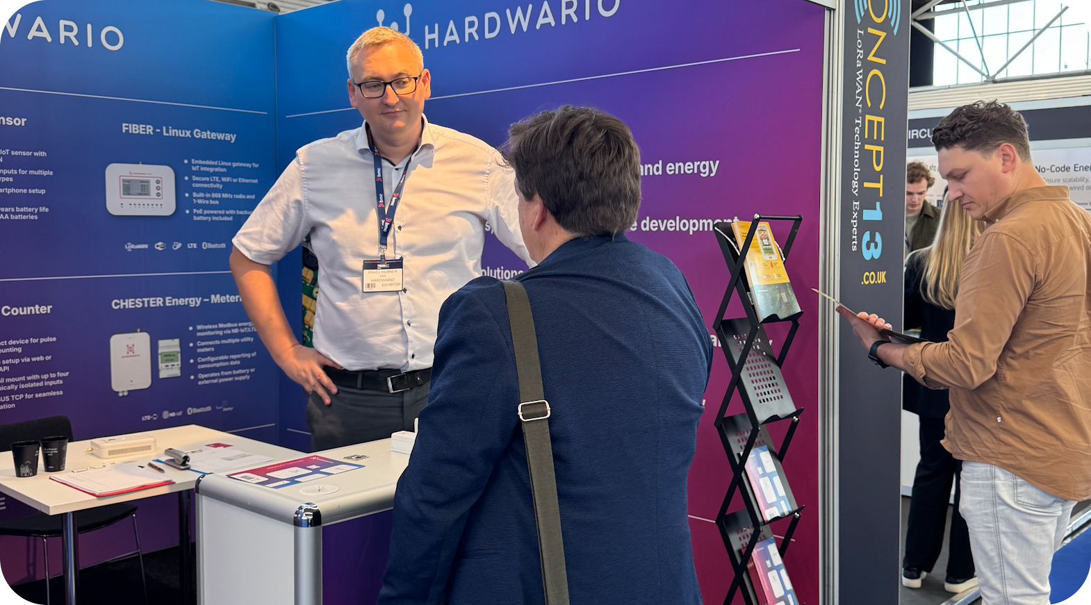
HARDWARIO helps companies around the world transfer data from the physical world to the cloud. It develops robust IoT hardware and firmware ready for industrial deployment, even in environments where conventional electronics fail. The CHESTER platform is designed to be flexible, programmable, and reliable in the field over the long term.
DeltaVue connects IoT devices with satellite communications, with a secure data pipeline and dashboard. It is an official Iridium Satellite Technology Development Partner, as well as Value Added Reseller and specializes in monitoring in remote areas where there is no mobile network. Typically, this is where access is difficult and missing critical sensor data can mean millions in damages. Its customers include governments, military, research teams, construction and mining.
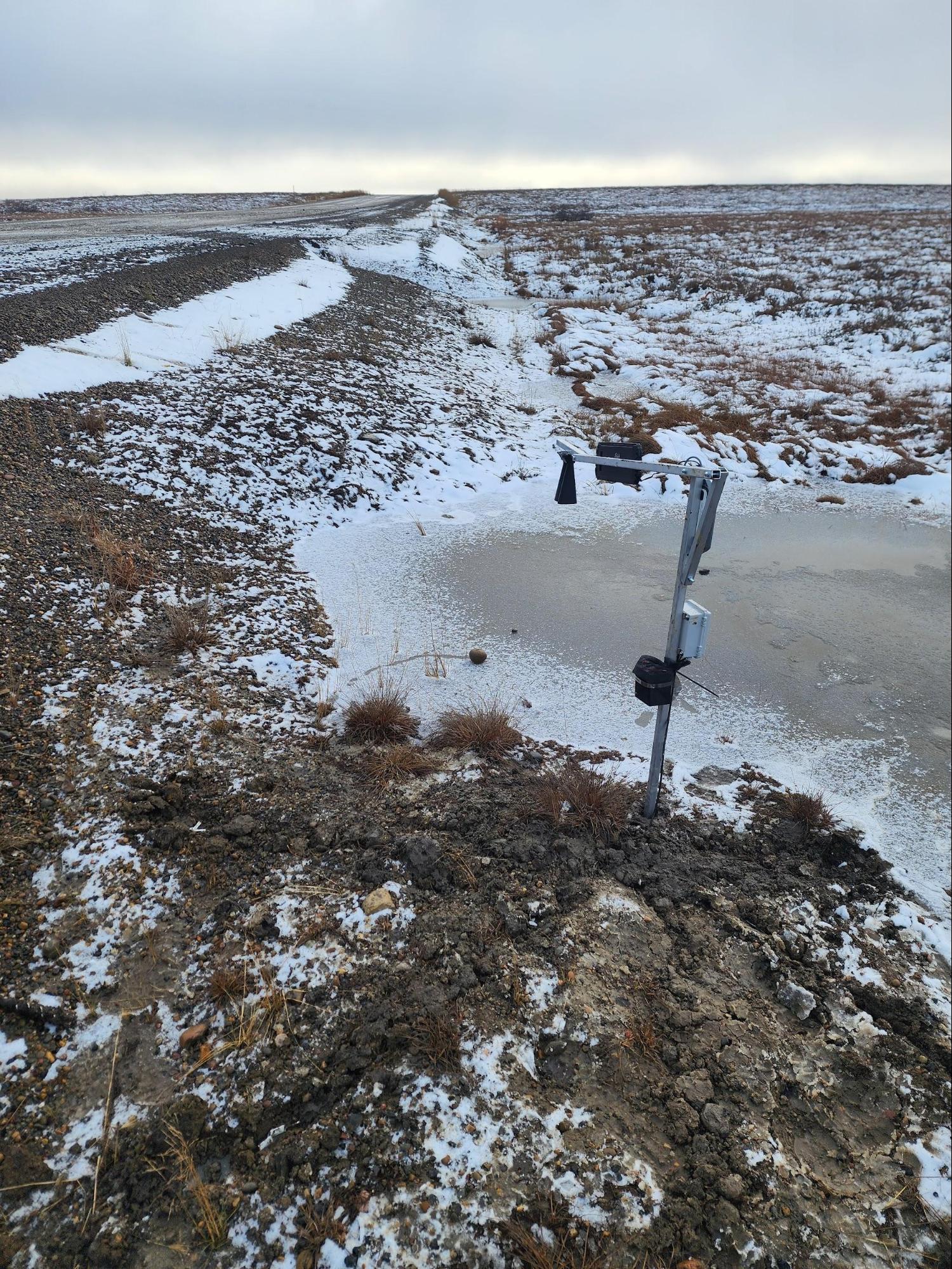
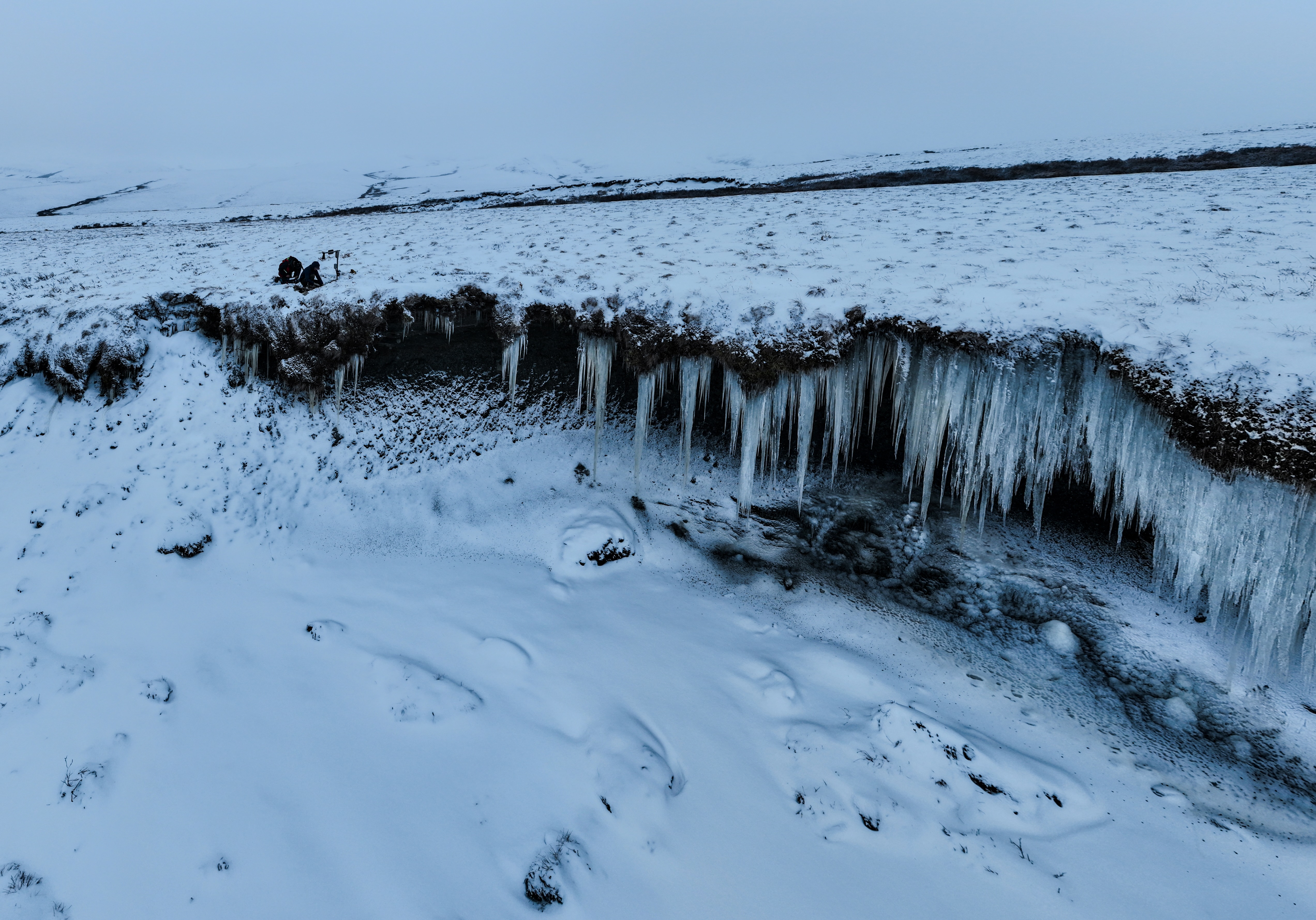
As part of a recent Government of Canada contract, DeltaVue developed an innovative sensor designed to monitor erosion affecting coastal and riverbanks, as well as slopes and other sensitive areas along roads and critical infrastructure. The Arctic highways monitored through this project play a vital role in connecting remote communities to supply centres, and any disruption or closure can have significant consequences for safety and the reliable delivery of essential goods.
Under traditional monitoring approaches, data collection depended on in-person site visits by technicians, requiring travel of hundreds or even thousands of kilometres to remote locations. The greater challenge, however, is the logistics of maintenance and repairs: many sites are difficult to access, repairs can take long periods of time and equipment failures often mean repeat trips, added costs, and delays. Without continuous monitoring, responding to terrain changes in a timely manner is not possible.
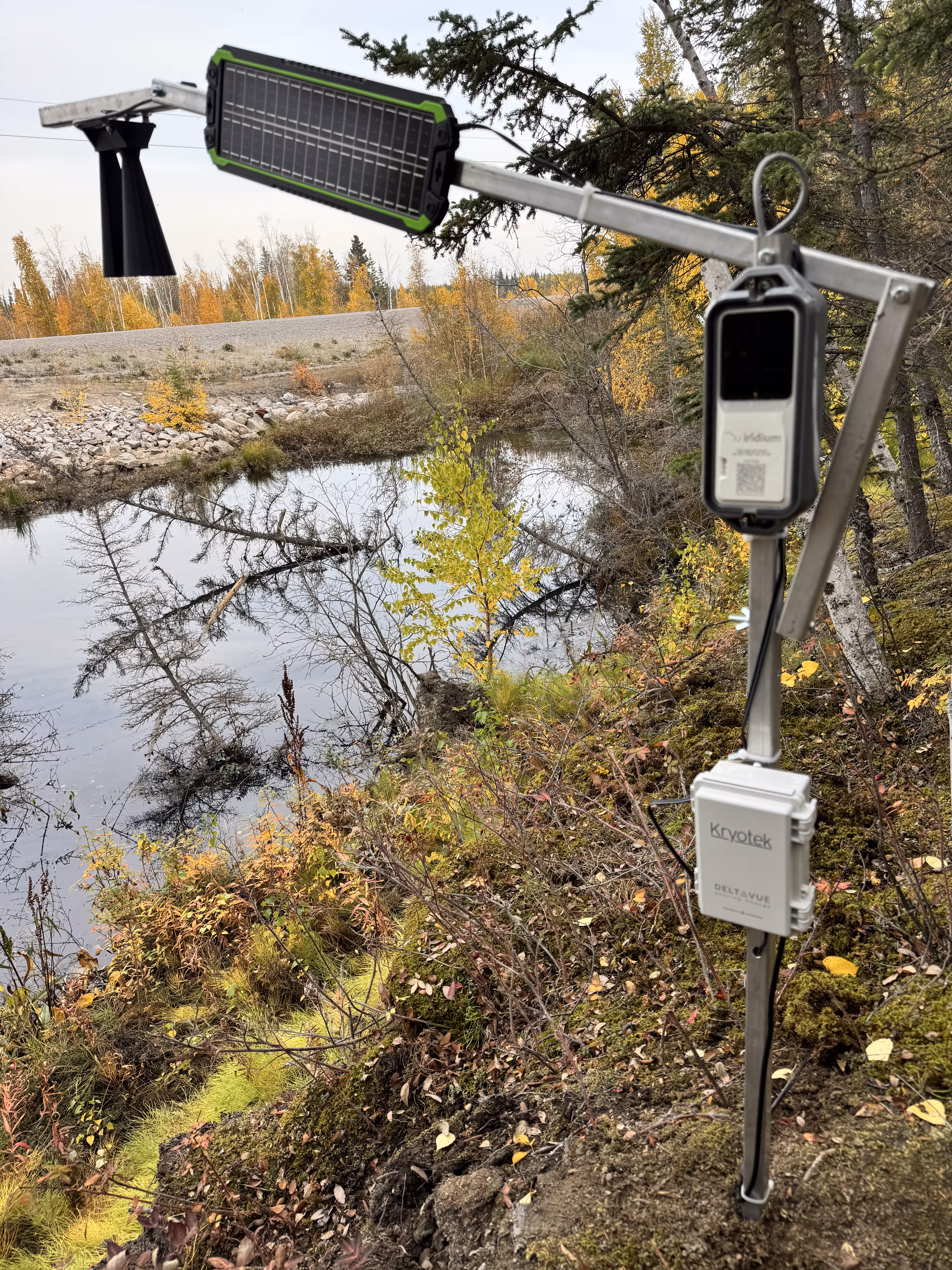
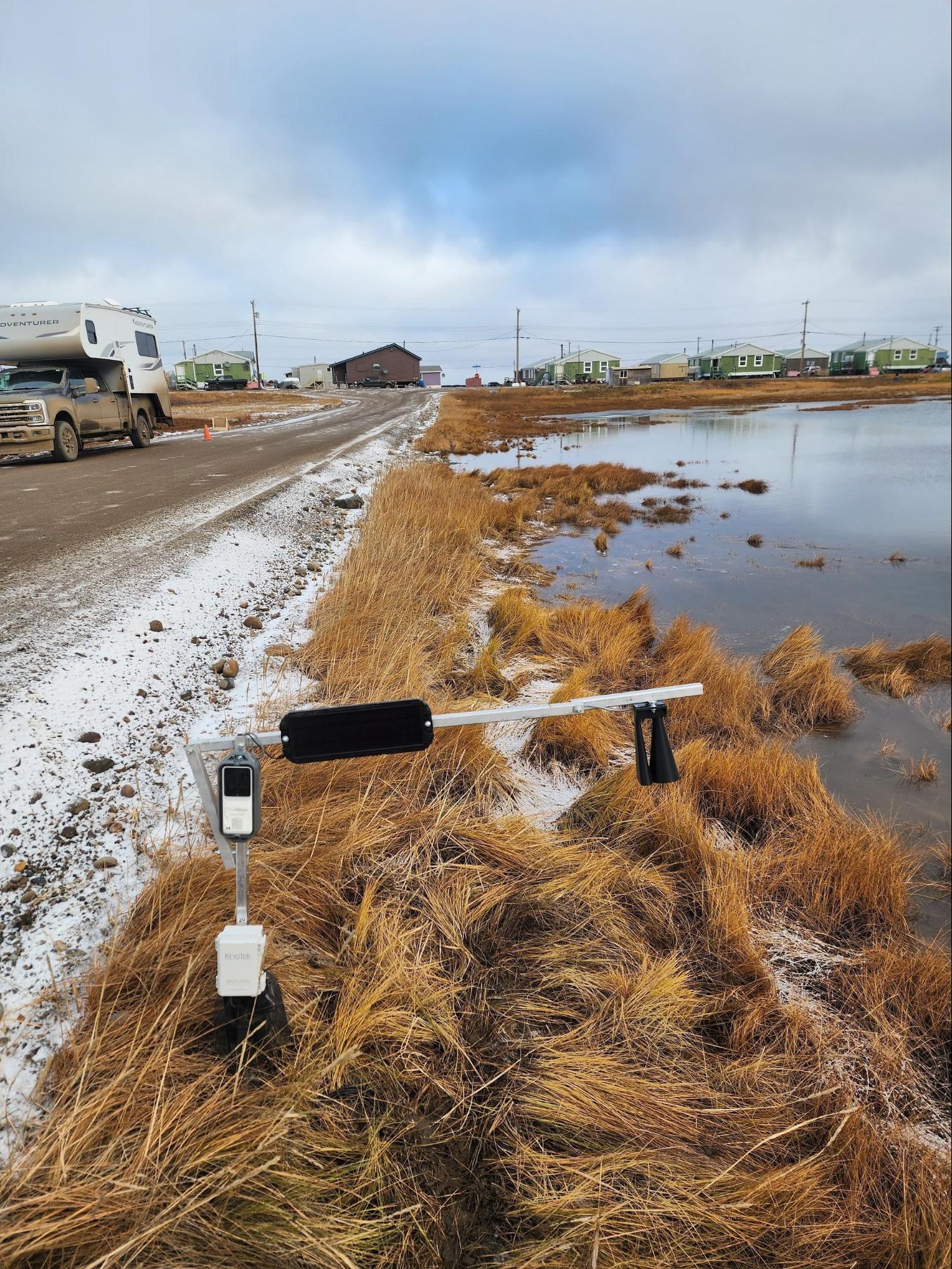
The basis of the system is CHESTER as a data unit. It communicates via Bluetooth with the Iridium Edge Solar unit, which provides satellite data transmission.
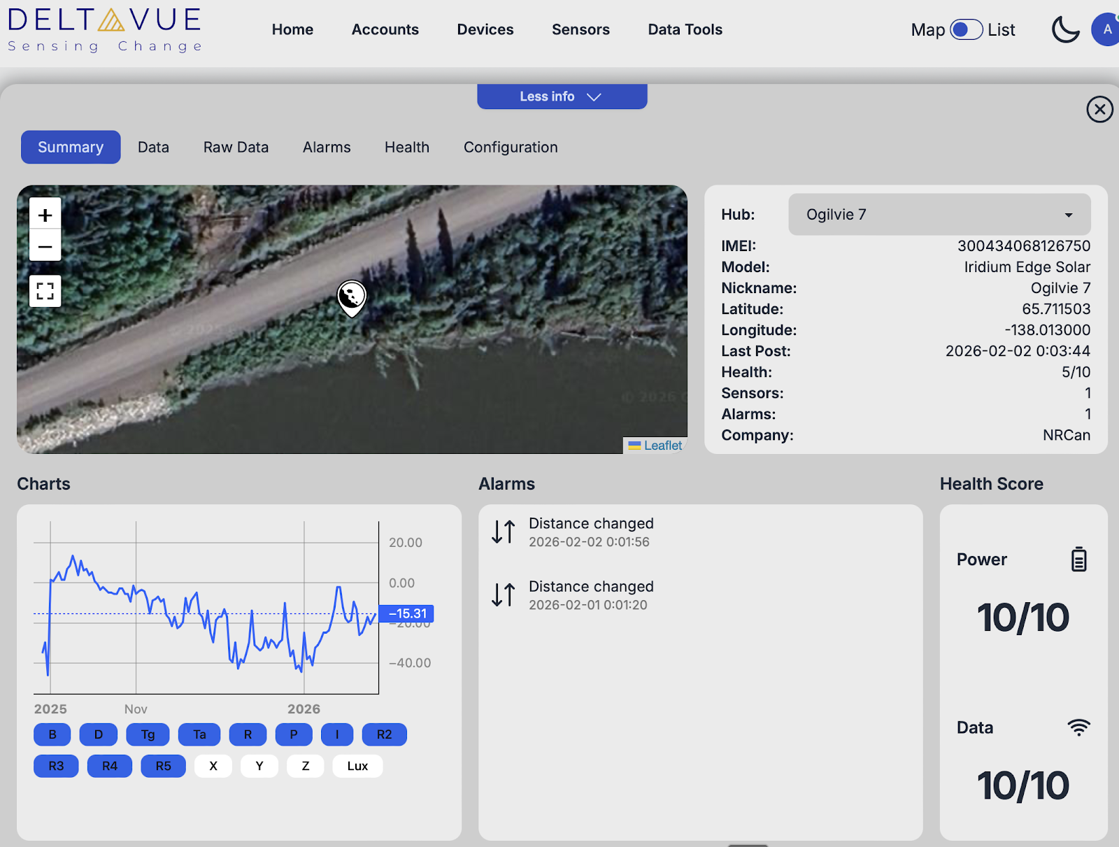
Sensors measure changes in the terrain. CHESTER collects the data and transmits it via Bluetooth to the satellite unit. The Iridium network sends the message to the cloud environment. The data is then securely transferred to the DeltaVue system, where it is available in the dashboard or via API.
The sensors used include tilt sensors for measuring soil inclination, ultrasonic rangefinders for monitoring distance and erosion changes, magnetic proximity switches, and other sensors connected via a 1-Wire interface.
Power is supplied by a combination of an internal NiMH battery optimized for extreme cold, an external backup battery, and a 5 W solar panel. The system is designed to withstand months of Arctic darkness without sunlight.
During the winter season, successful satellite communication was recorded at a temperature of - 48.8 °C. This is an important moment, as extreme cold is often the reason for electronic failure, particularly with battery operated systems.
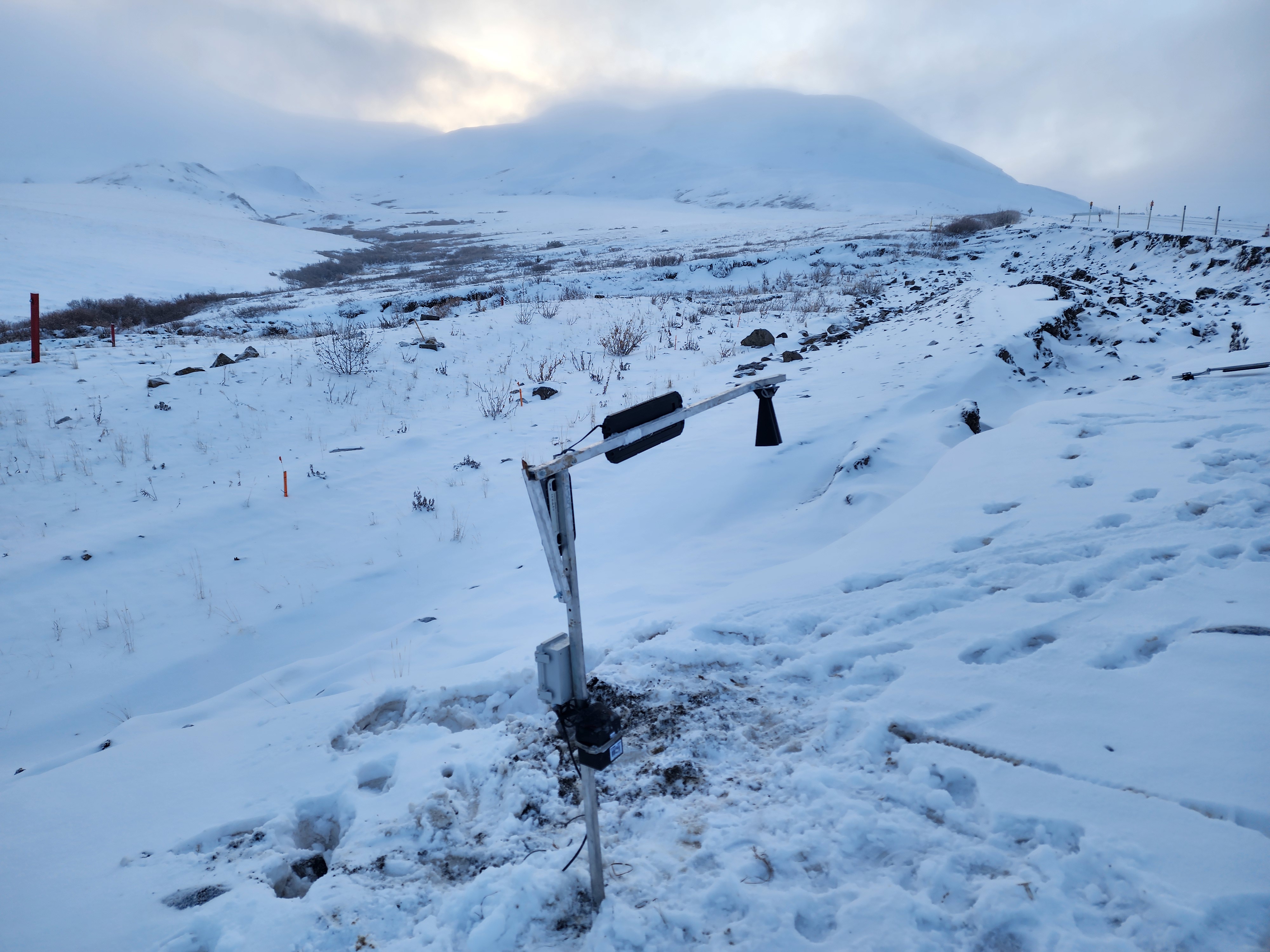
Despite these incredibly harsh conditions the hardware continues to functionas winter 2026 continues.
In the absence of continuous monitoring, infrastructure managers can only respond once damage becomes visible or a road is forced to close. In remote Arctic regions, where cellular and Wi-Fi connectivity do not exist, satellite monitoring is the most practical way to maintain situational awareness.
Closing an Arctic road is not merely a technical issue, however, as it can disrupt critical supply routes, restrict traffic, and create significant economic and safety impacts. In many cases, there are no alternative routes available.
Satellite-enabled early warning of erosion or slope movement allows authorities to act proactively, addressing risks before failures or accidents occur. This supports targeted repairs or stabilization at an early stage, reducing emergency interventions, avoiding major damage, and delivering substantial long-term cost savings.
DeltaVue is currently working on expanding its system to include the ability to transfer data directly to artificial intelligence large language models via API. The goal is to enable intelligent querying of data and advanced trend analysis.
This means that future users will not only be able to view graphs, but will also be able to ask questions such as, "Has there been an unusual tilt trend in this location in the last three weeks?" and the system will respond based on historical data.
Based on its experience in Canada, DeltaVue is preparing a pilot project for slope stability monitoring for Vale Mining in Brazil.
The principle is similar. Minor changes in slope or soil movement usually occur before a major landslide. If these signals can be detected in time, a serious event can be prevented.
The environment is different. Instead of extreme cold, there are high temperatures and heavy rainfall. However, the requirement for robustness and flexibility remains the same.
"CHESTER's extensive sensor capability, combined with the global reach of the Iridium network, allows DeltaVue to provide reliable data from the most remote and hostile environments on Earth, from the Arctic to the tropics", said the DeltaVue team.